Up hill and down dale – a walk through history
There’s a good deal of planning required when a group undertakes a bushwalk and so this walk at Munibung Hill involved the normal logistics needed to make the walk a success. Extracts from the notes supplied to walkers by Carolyn Budden give us an insight into the thoroughness with which the walk was organised.
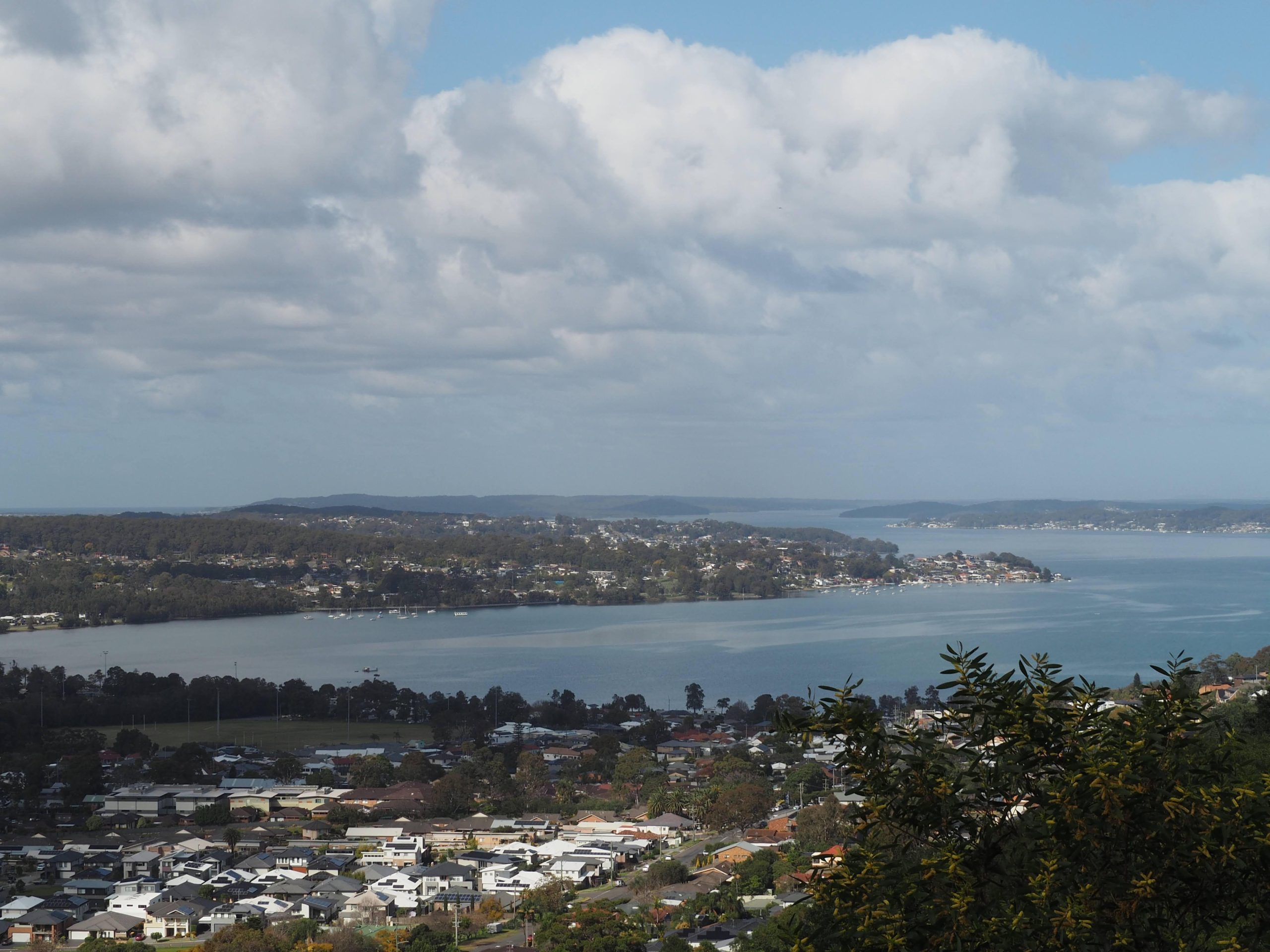
 THE WALK WILL TAKE IN MAGNIFICENT VIEWS over the lake and surrounding areas, says Carolyn. A gradual ascent with some short but steepish slopes take us to the summit.
From there we begin our descent which is mostly gradual but with some short stairs. A five minute diversion takes us to a lookout where we’ll enjoy more views of the lake surrounds.
(NOTE: We meet at the end of Quarry Road, Speers Point. We need to relocate via ride sharing to the start of our walk at the end of Blaxland Road, Macquarie Hills.)
Geology
Munibung Hill has some of the youngest rocks of the Newcastle Coal Measures. These rocks formed during the Permian period around 250 MYA, when tectonic plates were colliding and subducting along the eastern side of Australia. This resulted in a series volcanoes and high mountains in the New England region to the north. Rain and snow-melt flowed southward from the mountain peaks toward the ocean and carried gravel, sand, mud and large volumes of volcanic ash. A complex network of channels formed levees, with associated lakes and swamps.
Lake Macquarie is a young landscape feature 6,000—12,000 years old compared to Munibung Hill at 251 million years.
Aboriginal History
Threlkeld recorded that the hill was named ‘Konakonaba’. ‘The hill was believed to be a place where Aborigines communicated between mountains, and the site of a dreamtime story where a serpent brought water into the Lake. The top of Munibung Hill was a place where Aborigines watched Lake Macquarie fill with water 6000 years ago.’ ‘Today we walk where once they walked’ – takara milaythina mara mapali takara.
Mining and land use
European occupation of the area commenced in 1828 when William Brooks selected 1,280 acres encompassing the present day suburb of Speers Point. Brooks operated a coal mine on the western side of the hill (near present day Hopkins Street) from 1843 – c1856. The Lochend Colliery was active from 1843 to 1856. Coal was pushed on carts along a narrow gauge tram line to a jetty at Speers Point from where it was shipped to Sydney. William Speer, a Sydney businessman and timber merchant, acquired the property in about 1870
 Flora and fauna
The track we’ll walk takes us through open grassland, avenues of trees with birdsong all around and lush Gondwana like forest areas. Munibung Hill is dated as having been formed 251 Mya so the plants in this area had their origins millions of years ago, long before dinosaurs. These plants are the current living examples of ancient times past.
The higher parts of the walk are dominated by a Spotted Gum (Corymbia maculata)/Casuarina (Allocasuarina torulosa) open forest.
The walk within the Hawkins Creek catchment includes species dominated by the Turpentine (Syncarpia glomulifera).
The Bandicoot (Koworowal) is known to live around the southern areas of Munibung Hill. Secretive little mammals shown by the presence of many diggings or mounds of soil that they make while foraging for roots or building their shelters where they rest during daylight hours before coming out at night. They are what is referred to as ‘ecosystem engineers’ since they aerate the soil, help with water absorption and build soil fertility.
There is a plethora of birdlife evident which can be heard and hopefully seen whilst walking quietly along the bush tracks. Whip birds, finches, wrens, kookaburras and many other species abound.
Completing the walk at the southern end is a final lookout across the lake—Birabaan Lookout.
END NOTES: We had a group of about 16 walkers who were amazing in their interest and resilience. We concentrated on the geology, plant species, even those invasive ones, and Aboriginal significance.
A few stats. Time duration ..1.5 hours – as it’s a bit steep in some sections, there were some stops for rest before going on. Distance .. Just shy of 4 km in length, not a long walk but given its steepness, that was plenty.
August, 2023
More pictures in the Magazine version – MMM … Issue 40, October – November 2023

