We are walking in the greater Cockle Creek catchment, an upper watershed area, a micro bioregion—all ways to remind us we are part of, not apart from, the country of our ancestors.
After a stop over at Grandfather Rock, head into a valley before climbing up to the Mountain View Lookout, which is located about 30 or so metres south, off the track. This is good place for a breather and for any stragglers to catch up if you are part of a group. Time for a cuppa to keep hydrated—warm weather or not. Continue walking east along the formed access road to the Munibung Hill trig station (left) or Ocean View Lookout (straight ahead).
Custom map created for MHCS by David Bretreger
Wonta, in Awabakal language means: where is this place? (1)
Enter: Seventh Street, Boolaroo is the starting point for this walk.
NOTE: A random internet search for Munibung Hill – which can be accessed from locations on the north, south, east and west – without providing more details, will most likely present a rather confusing map compared with the directions supplied here. When using a search engine such as Google maps it helps to specify an address, in this case Seventh Street, near Cnr Braye Street, Boolaroo.
(1) Source: An Australian Language as Spoken by the Awabakal, L. E. Threlkeld. 1892
There are no toilets, no picnic facilities and no disposal or recycling bins. The nearest are at Cardiff, Warners Bay, Speers Point and Boolaroo.
 Dogs on leashes only. No trail bikes. Please carry out what you carry in – don’t rubbish Munibung Hill. If you come across what other people have disposed of, consider picking it up and disposing of it thoughtfully. Help us care for the habitat of local native plants and animals. Thank you.
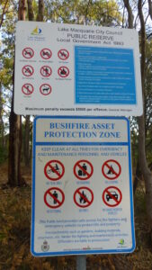
<< No signage other than Council and NSW Rural Fire Service notices. Please observe these messages and bring them to the attention of others.
There are no official car parks at the start of tracks, it is therefore important to respect the residents who live in close proximity to these areas.
When driving around Munibung Hill at night remember we are sharing the roads with our native wildlife, so take it slow and watch out for animals on the road.
For your safety and personal care, even for a short walk on a fine day, carry a light pack with a weatherproof jacket, water (1 litre per person for every 3 hours of walking), some high energy food and a first aid kit. Wear a sunhat, sunglasses, sunscreen. Insect repellent can also make your walk more comfortable and be sure to take a bag to carry any rubbish out with you.