Geodiversity is an important aspect of our heritage that gets overlooked in favour of the more readily seen biodiversity. This walk is intended to correct the imbalance. Geology and geodiversity, those things that take place underground, determine to a great extent what takes place above ground.
Munibung Hill has some of the youngest rocks of the Newcastle Coal Measures. These rocks formed during the Permian period around 250 MYA, when tectonic plates were colliding and subducting along the eastern side of Australia. This resulted in a series volcanoes and high mountains in the New England region to the north. Rain and snow-melt flowed southward from the mountain peaks toward the ocean and carried gravel, sand, mud and large volumes of volcanic ash. A complex network of channels formed levees, with associated lakes and swamps.
The boundary between the Boolaroo Formation and the Moon Island Beach Formation, the uppermost formation of the Newcastle Coal Measures before the Triassic terrestrial sediments dominate (see Mackenzie and Britten, 1969).
This boundary between the Boolaroo and Moon Island Beach Formations is located roughly at the crest of Lawson Rd on the highest eastern foot ridge to the hill (1). Two coal seams, the Fassifern and Great Northern Seam, are exposed at different heights on Munibung, separated by the Bolton Point Conglomerate. The upper section of Munibung Hill is formed from the Teralba Conglomerate Member, which forms the cliff lines exposed on the eastern and southern sections of Munibung. The Awaba Tuff underlies the Great Northern Seam and is most likely the source of yellow pigment (ochre) sought by Awabakal men for ritual hunting and scouting parties.
There are weathered rock formations and small caves off the bluff to the north.
Lake Macquarie (Awaba) was formed in its current state following the Pleistocene Glaciation, which peaked about 18,000 years Before Present(BP). Sea levels at the time were about 168 metres below current sea level. The final marine transgression stabilized approximately 6000 years BP at about current sea level (0 m AHD).
There are many creek catchments to the east and west.
Lake Macquarie is a young landscape feature 6,000—12,000 years old compared to Munibung Hill at 251 million years.
Munibung Hill was also the site of many and varied industrial events dating back to the early 1800s.
For example a coal mine site – the Lochend Colliery – was active from 1843 to 1856. Coal was pushed on carts along a narrow gauge tram line to a jetty at Speers Point from where it was shipped to Sydney.
Since European settlement, the sound of heavy earthmoving equipment echoed around her slopes. The quarry off Quarry Road, Speers Point, supplied gravel for a variety of purposes one of them being to build roads to the Catalina Flying Boat Station at Rathmines on the western shores of Lake Macquarie. It is a sheer face conglomerate: sandstone materials with gravels and cobbles embedded in it.
Off Hopkins Street, two reclaimed gravel quarries are now the site for a residential housing development. And there was a fourth quarry on the southern end of Munibung Hill. It was rehabilitated by LMCC in the mid 1980s.
Further to the north-west was Cockle Creek Smelter, built in 1896, the site for processing lead and zinc supplied from mines in Broken Hill, western NSW. The smelter closed in 2003. Remediation of the site has allowed for it to become a housing estate and commercial retail area.
There is more information about Munibung Hill held in the Community History Department, Lake Macquarie Libraries. Check the link to read.
Featured image courtesy Bob Todd: Looking south along the eastern flank with Lake Macquarie in the background
The map has an interactive feature. Place your cursor on the symbol to bring up an information box.


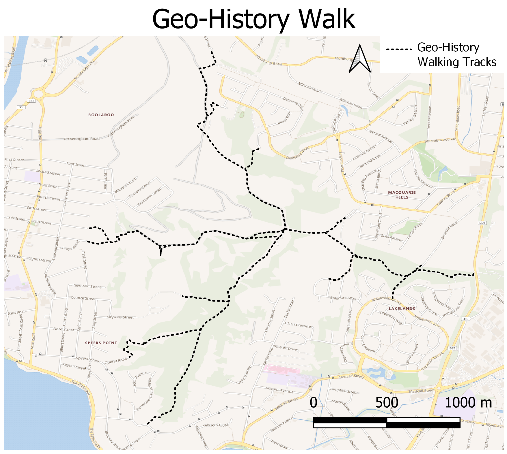
Custom map created for MHCS by David Bretreger
Interactive symbol feature by Lachlan Carney, Jezweb
Wonta, in Awabakal language means: where is this place? (1)
Get started from one of these locations:
1. Quarry Road, Speers Point
2. Kuraman Close (off Delaware Drive), Macquarie Hills
3. Macquarie Road, Macquarie Hills, or
4. Grasmere Way, Lakelands
NOTE: A random search for Munibung Hill – which can be accessed from locations on the north, south, east and west – without providing more details, will most likely present a rather confusing map compared with the directions supplied here. When using a search engine such as Google maps it helps to specify a suburb and street name, such as those listed here.
(1) Source: An Australian Language as Spoken by the Awabakal, L. E. Threlkeld. 1892
There are no toilets, no picnic facilities and no disposal or recycling bins. The nearest are at Cardiff, Warners Bay, Speers Point and Boolaroo.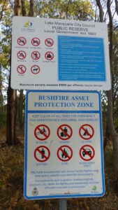
Dogs on leashes only. No trail bikes. Please carry out what you carry in – don’t rubbish Munibung Hill. If you come across what other people have disposed of, consider picking it up and disposing of it thoughtfully. Help us care for the habitat of local native plants and animals. Thank you.
<< No signage other than Council and NSW Rural Fire Service notices. Please observe these messages and bring them to the attention of others.
There are no official car parks at the start of tracks, it is therefore important to respect the residents who live in close proximity to these areas.
When driving around Munibung Hill at night remember we are sharing the roads with our native wildlife, so take it slow and watch out for animals on the road.
For your safety and personal care, even for a short walk on a fine day, carry a light pack with a weatherproof jacket, water (1 litre per person for every 3 hours of walking), some high energy food and a first aid kit. Wear sturdy shoes or boots, a sunhat, sunglasses, sunscreen. Insect repellent can also make your walk more comfortable and be sure to take a bag to carry any rubbish out with you.