The track is located in the Hawkins Creek catchment, at the foot of the cliff face. This land owned by Mersie Hardy, was sold in the 1920s to the Hawkins family, who developed the site into a gravel quarry from the 1930s to 1980s. The quarry supplied material for the construction of WIlliamtown air force base as well as road construction to Rathmines and between Booragul and Glendale.
What we see is a sheer face conglomerate: sandstone materials with gravels and cobbles embedded in it.
The cliff face has the appearance of a vertical garden, not unlike the ones we see planted out on city buildings. Nature has been practising the art of gardening for millions of years and this is yet another example of her creativity. The mosses and lichens are busy turning rock into sufficient soil for the plants to get a ‘footing’. Imagine what this cliff face will be like in a hundred or a thousand, even a million years from now.
 The area is now badly infested with introduced weeds such as Morning Glory (Ipomaea indica), Lantana (Lantana camara) and Pampass Grass (Cortaderia selloana) to name three, but don’t let that deter you from walking among some good examples of native species. This short walk packs a real punch with more than 30 natives, of which we list a few to look out for. Trees such as the Native Tamarind (Diploglottis australis) [picture at left] and Red Ash (Alphitonia excelsa), shrubs like the Native Elderberry (Sambucus australasica), ferns such as Birds Nest Fern (Asplenium australasicum) and the Lawyer Vine (Smilax australis), which is a climber.
This short walk connects with a number of longer walks leading to the north-south ridgeline where lookouts provide expansive views across Lake Macquarie.
Custom map created for MHCS by David Bretreger
Wonta, in Awabakal language means: where is this place? (1)
Enter from Quarry Road, Speers Point. At either end it is possible to connect with other walks that include one of the four suggested lookouts. Having got a feel for Munibung Hill, let this be the start of more regular visits as part of a self-managed outdoor green prescription program.
NOTE: A random internet search for Munibung Hill – which can be accessed from locations on the north, south, east and west – without providing more details, will most likely bring up a rather confusing map compared with the directions supplied here. When using a search engine such as Google maps it helps to specify an address, in this case Quarry Road, Speers Point.
(1)Source: An Australian Language as Spoken by the Awabakal, by L. E. Threlkeld. 1892
There are no toilets, no picnic facilities and no disposal or recycling bins. The nearest are at Speers Point and Boolaroo.
 Dogs on leashes only. No trail bikes. Please carry out what you carry in – don’t rubbish Munibung Hill. If you come across what other people have disposed of, consider picking it up and disposing of it thoughtfully. Help us care for the habitat of local native plants and animals. Thank you.
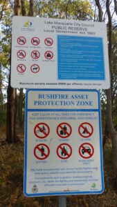
<< No signage other than Council and NSW Rural Fire Service notices. Please observe these messages and bring them to the attention of others.
There are no official car parks at the start of tracks, it is therefore important to respect the residents who live in close proximity to these areas.
When driving around Munibung Hill at night remember we are sharing the roads with our native wildlife, so take it slow and watch out for animals on the road.
For your safety and personal care, even for a short walk on a fine day, carry a light pack with a weatherproof jacket, water (1 litre per person for every 3 hours of walking), some high energy food and a first aid kit. Wear a sunhat, sunglasses, sunscreen. Insect repellent can also make your walk more comfortable and be sure to take a bag to carry any rubbish out with you.